Outdoor map tiles for your apps
Built using the wonderful Open Street Map database, enhanced by locally available data, available for online and offline use.
Features
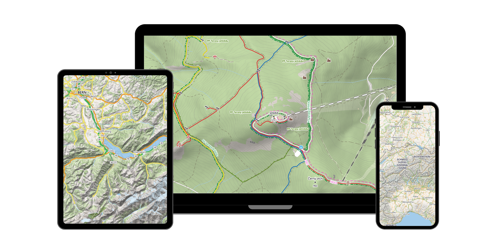
See how you can use our maps
Beautiful outdoor style
Your users will never get lost in the great outdoors again.Coloured hiking trails
Stacked trails always ensure great awareness.
Cycleways
Bicycle trails never get mixed with roads or hiking trails.
Precise contours
Each country has a different source of contours.
Map depth thanks to hillshading
See the terrain profile at the first glance.
Many tourist related POIs
From mountains and water springs to restaurants and public transport stops.

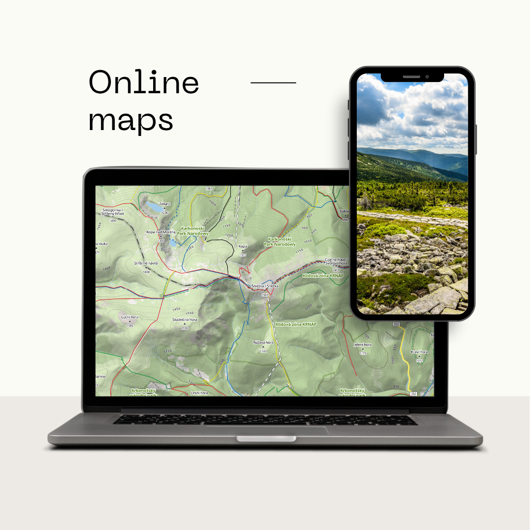
Online map tiles
Use a single URL to load tiles into your map.Use your favourite library
Our vector tiles are supported by popular libraries like maplibre and leaflet.
Interact with any map object
Vector tiles allow you to interact with any POIs, roads or other objects.
Always up to date
Map data of the whole world are usually updated once per week.
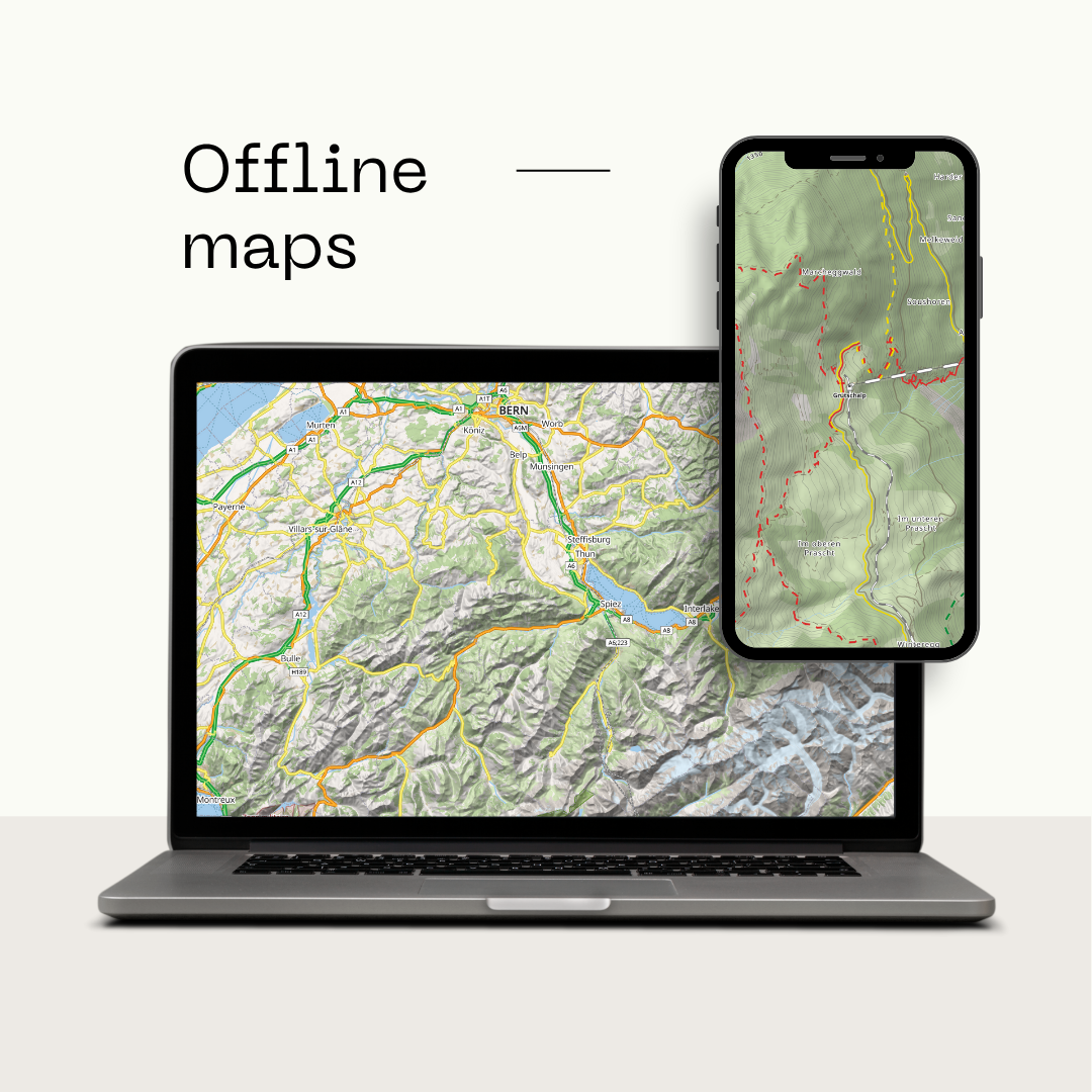
Offline map tiles
Offline map extracts let your users keep using maps without internet connection. Contact us to discuss offline data for your project.Choose your format
We provide extracts in MBTiles or PMTiles file formats.
Separated datasets
Choose what data you need - OSM data, contours or hillshading.
Prepared country extracts
We create our extracts per country. The list of available downloads is always growing.
Custom extracts
Do you need to split a country into offline regions? Merge multiple countries? Let us know.
3D terrain
Use our terrain data to display 3D terrain of any map layer.External satellite layers
Use any external satellite tiles to exaggerate the terrain in your maps.
Rotate and tilt
Inspect mountains or different areas to see how elevated they are.
3D buildings
Add fill extrusion to building polygons to create a 3D building effect on high zooms.
Working examples
Who uses MapRiot?
Take a look at these projects to see how they are using MapRiot outdoor map tiles.
Hory.app contains a database of more than 200,000 mountains in more than 30 countries! Users log their mountain visits when they reach the top and get points that are equal to the mountain's altitude!
Venku.app brings a new perspective to outdoor activities. It combines orienteering with exploring new and unknown places!
Pivandr will also take you outside but instead of exploring unknown places, you will get to taste different brands of beers in breweries around Europe!
Are you interested?
Create a free account to get your API key, or try our demo map first!